
The terminus of the Deming Glacier from a slope above the Middle Fork Nooksack. Click to enlarge any photo.
A YouTube video shows the terminus of the rapidly receding Deming Glacier and the landslide scarp that was the source area of the May 31, 2013 debris flow. That flow swept down the Middle Fork Nooksack. The video, by MBVRC’s Dave Tucker, is at YouTube: http://youtu.be/_A2E7FUXXaY
A report of the August 7, 2013 cross-country hike to the Deming terminus can be found here on this website. Paste ‘Nooksack debris flow’ (no quotes) into the search box above right to access all the pages reporting on the 2013 debris flows.
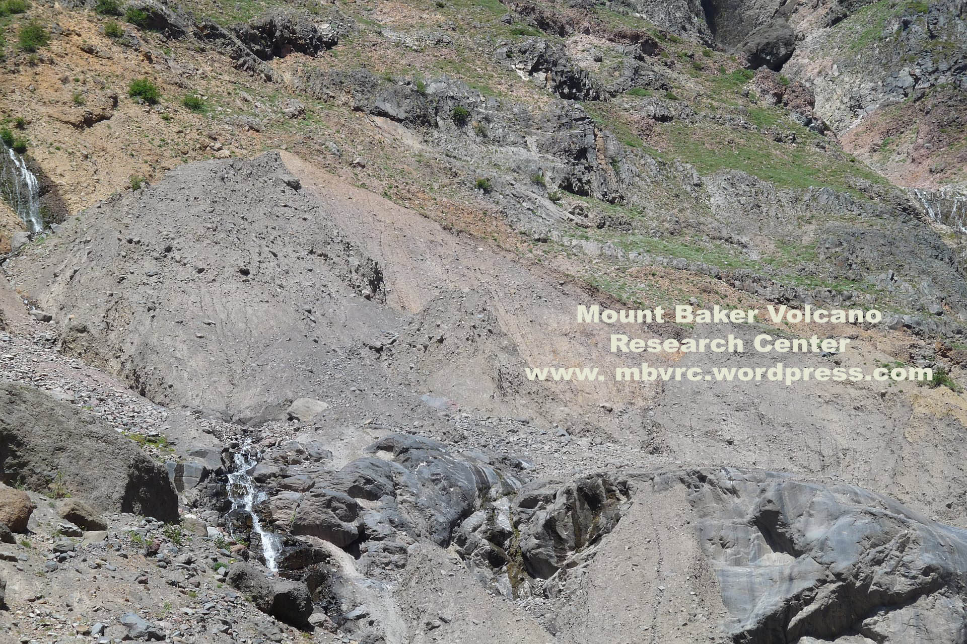
The source of the large May 31 landslide (‘debris avalanche’) shows clearly on this photo. The view looks up from 100 meters lower, over the 30-m-high rock wall (note waterfalls). The Deming Glacier flows over this wall just out of view to the right (southeast).


Leave a comment